By Manon Roca
Date : July 2024, 10 days
Who: two girls, French passports
Where: Kalaikhum – Rushan – Jizev Valley – Khorog – Eshkashem (try to be there on a Saturday for the Afghan market) – Yamchun – Vrang – Langar – Bulunkul Lake – Murghab – Karakul Lake
Who: two girls, French passports
Where: Kalaikhum – Rushan – Jizev Valley – Khorog – Eshkashem (try to be there on a Saturday for the Afghan market) – Yamchun – Vrang – Langar – Bulunkul Lake – Murghab – Karakul Lake
The Pamir highway - Manon Roca
Visa / Special Permits
Visa for Tajikistan
There are two options:
GBAO Permit (for the Pamir)
To enter the Pamir region, you need a GBAO (Gorno-Badakhshan Autonomous Region) permit.
I recommend reading about the Badakhshan region beforehand : it helps you better understand the area and why you’ll sometimes hear “Welcome to Badakhshan” at checkpoints.
Most travelers get the permit in Dushanbe. It costs between $15 and $30 (I don’t remember exactly).
I came from Uzbekistan, and my first city in Tajikistan was Panjakent.
That’s where I got my GBAO permit and I paid barely $1.
Coordinates of the building: here
I also completed the OVIR registration there at the same time.
There are two options:
- E-visa: Apply online at evisa.tj. A single-entry e-visa costs $30; single-entry + GBAO permit costs $50.
- Visa on arrival (what I did): I got it at the border and didn’t have to pay.
GBAO Permit (for the Pamir)
To enter the Pamir region, you need a GBAO (Gorno-Badakhshan Autonomous Region) permit.
I recommend reading about the Badakhshan region beforehand : it helps you better understand the area and why you’ll sometimes hear “Welcome to Badakhshan” at checkpoints.
Most travelers get the permit in Dushanbe. It costs between $15 and $30 (I don’t remember exactly).
I came from Uzbekistan, and my first city in Tajikistan was Panjakent.
That’s where I got my GBAO permit and I paid barely $1.
Coordinates of the building: here
I also completed the OVIR registration there at the same time.
Useful Apps / Websites / Groups
- iOverlander: to find guesthouses offline, road updates, checkpoints, etc.
- Organic Maps: similar to Maps.me but without ads (same maps).
- Google Translate: download Russian and Tajik offline dictionaries beforehand. Very few people speak English, even in guesthouses.
- WhatsApp group “Silk Road Overlanders”: a community of travelers crossing the Silk Road by car, motorbike, bicycle, or even on foot.
Join here
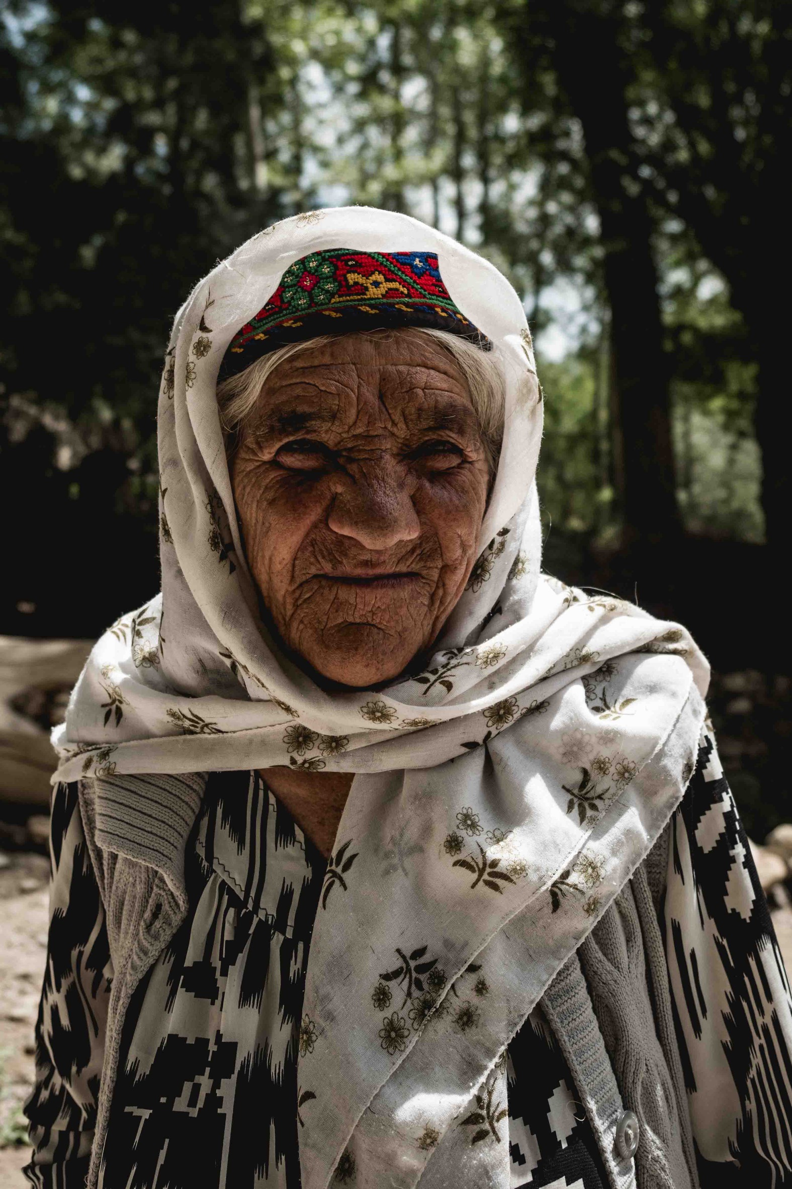
Woman of Gorno-Badakhshan - Manon Roca
Guesthouses
I didn’t book anything in advance. I always found a room, even during peak season.
I chose based on reviews on iOverlander, but not all guesthouses are listed there and they’re not necessarily the best ones.
I don’t have any specific recommendations. They’re all fairly similar. The food isn’t amazing (I’m not particularly picky, but I didn’t really connect with Tajik food…).
I chose based on reviews on iOverlander, but not all guesthouses are listed there and they’re not necessarily the best ones.
I don’t have any specific recommendations. They’re all fairly similar. The food isn’t amazing (I’m not particularly picky, but I didn’t really connect with Tajik food…).
Hitchhiking
I chose to hitchhike because it’s by far the cheapest way to travel in this region. I did it during high season, which made things much easier.
It’s relatively easy to hitchhike from Kalaikhum to Murghab (or even all the way to Kashgar in China if you continue) : basically most of the Pamir Highway (M41). There are many trucks heading toward China. It’s slow, but it works.
Reaching the Wakhan Corridor is more complicated but still doable. I alternated between hitchhiking and local transport (which is very affordable), up to Langar.
Two sections are particularly difficult to hitchhike. I managed because I was traveling in high season and joined tourist groups doing the same route.
Otherwise, you’ll likely need a taxi:
If possible, find other travelers to split the cost.
It’s relatively easy to hitchhike from Kalaikhum to Murghab (or even all the way to Kashgar in China if you continue) : basically most of the Pamir Highway (M41). There are many trucks heading toward China. It’s slow, but it works.
Reaching the Wakhan Corridor is more complicated but still doable. I alternated between hitchhiking and local transport (which is very affordable), up to Langar.
Two sections are particularly difficult to hitchhike. I managed because I was traveling in high season and joined tourist groups doing the same route.
Otherwise, you’ll likely need a taxi:
- Langar → Murghab: taxis charge at least 1500 TJS (around $140).
- Murghab → Osh (Kyrgyzstan): around $300.
If possible, find other travelers to split the cost.
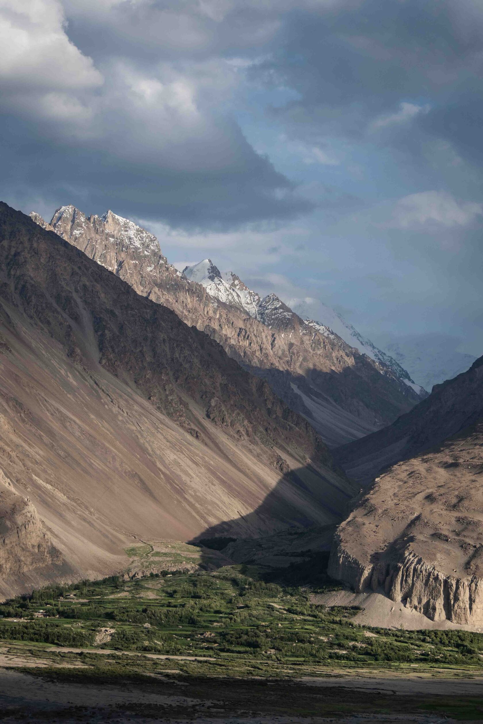
Wakhan region - Manon Roca
Itinerary
We start our journey in Kalaikhum, a small town on the Panj River that serves as a gateway to the Pamirs, where we prepare for the remote valleys ahead. From there, we continue to Rushan, an administrative center in the valley, where we can find small guesthouses and local shops, while enjoying our first glimpses of the surrounding mountains. We then travel through the Jizev Valley, a narrow and green valley dotted with traditional villages. We hitchhiked up into the mountains, and my courageous friend even took a bath along the way.
Next, we reach Khorog, the capital of the Gorno-Badakhshan region, which is truly fascinating, if I have to be honest. Here, we can visit the Pamir Museum, explore the bazaar, and walk across the suspension bridge over the Pyanj River. After Khorog, we leave the Pamir Highway to enter the Wakhan region, first stopping in the city of Eshkashem, a small border post with Afghanistan. We tried to be there on a Saturday to experience the lively Afghan market. From there, we continue to Yamchun, famous for the ruins of Yamchun Fort perched on a hill with stunning views over the valley and its typical small village life.
We then reach Vrang, a historic village with old fortifications and religious sites, set in very wild and remote landscapes. From Vrang, we travel to Langar, a village close to the Afghan border, which serves as our base to explore the surrounding valleys and experience local pastoral life. After Langar, we return to the Pamir Highway, where our paths split.
My friend left directly for Kyrgyzstan while I continued hitchhiking to Bulunkul Lake, a glacial lake at over 3,500 meters altitude, surrounded by mountains that seemed like the end of the world. My anxiety was high, being so far from everything and without connection, so I decided to leave early the next morning. I hitchhiked and waited a long time until a truck finally stopped and took me to Murghab, the highest town on this itinerary at around 3,650 meters. From there, the hardest part was yet to come: reaching Kyrgyzstan by hitchhiking. I got lucky to join a group tour of Korean travelers who accepted me in their car. We drove past Karakul Lake, a breathtaking glacial lake at 3,900 meters, framed by snow-capped peaks, marking the final stop of this journey before crossing the border and leaving Tajikistan.
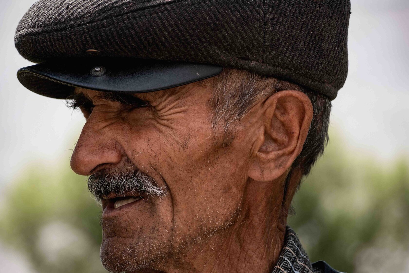
Man from the Wakhan region - Manon Roca
Overall Impression
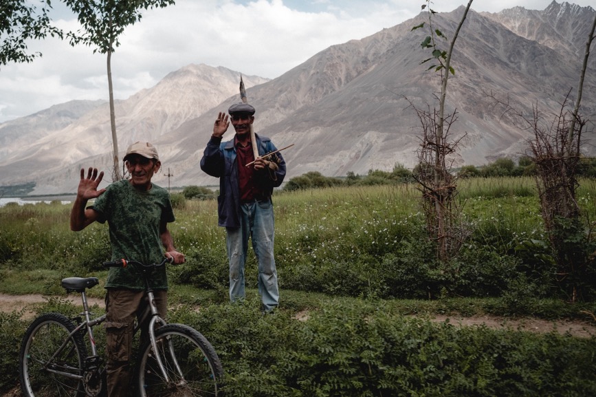
Beyond the logistics, Southern Tajikistan is honestly one of my favorite places in the world.
You feel incredibly small surrounded by massive mountains and endless roads. The people are exceptionally kind and welcoming. And the closeness to Afghanistan (even though I visited earlier this year) is deeply moving.
I won’t say more : just look at a few photos and go.
It’s not the most comfortable trip: rough roads, high altitude, occasional food poisoning…
But you quickly forget all of that in front of such overwhelming beauty.
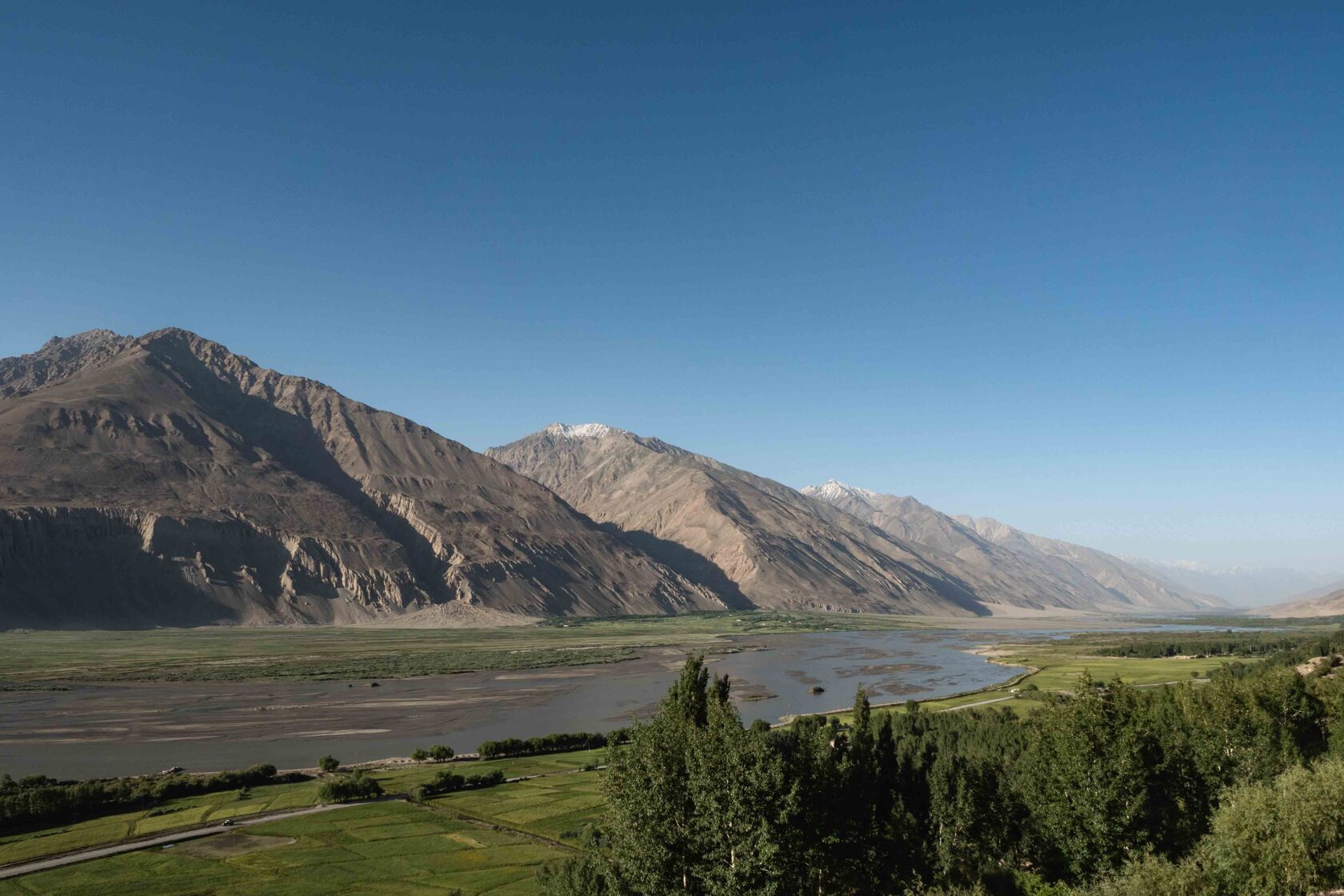
On the other side of the river is Afghanistan - Manon Roca
Text and photos by Manon Roca. All rights reserved.
You can see more of my work on Instagram.
You can see more of my work on Instagram.